Davis Peak, North Cascades Winter Ascent
Winter mountaineering is tough in the Pacific Northwest… We are bounded by the short daylight hours, long forest road approaches and dreaded post-holing. With an unusually high snow-line level coupled with an even more unusual high pressure window, Liz and I decided to attempt Davis peak… A 7000’ mountain, just south of the Picket Range. Below is our GPX Tracks:
After camping in sub 20 degree temperature the weekend prior, I certainly wasn’t motivated to pack out the tent and winter camp again. We opted for a peak that could reasonably be done in a single day. We climbed a mountain called ‘Betty’s Jugs’ the day prior and then drove to Cascade River Road to sleep in our truck. It was 20 degrees outside, but we were cozy with our mattress, sleeping bags and blankets. We woke up at 7AM and drove the gas station in Marblemount for some hot chocolate… A big perk of car-camping. Next stop was the Gorge Overlook Trail outside of Newhalem.
There were two reasons why Davis peak was an ideal choice for a winter day ascent. The ‘trailhead’ is located off highway 20. Highway 20 does not close until the dam, access was easy and direct. Secondly, after a period of high pressure, we had presumed that the south faces would be firm and conducive to fast travel. This presumption proved mostly true, however, this peak was no freebie.
The climb is only about 3 miles in length one way, but gains 6000’ in elevation. According to my math….. that is steep! The south slopes burned in 2015 and makes for some unpleasant burned-forest shenanigans. The forest section was roughly 3000’ in gain. It’s pick your way through the forest, although recent LIDAR data has made the route finding easier. There are a few steep slabs and boulder to navigate, but with good route finding and minor scrambling skills, it’s not too bad.

The burnt forest approach of Davis Peak. There is a ton of deadfall, widow makers and scratchy brush. This would be unpleasant in the summer.

Class 3 slabs. A few sections reach class 4, but they aren’t too bad with proper route finding.
Once we reached the snowline, we donned boots and crampons. Liz spotted a massive mountain goat, who was curious of our presence. The goat watched us for 20 minutes or so, not moving at all. I’m sure the goats up here don’t interact with many people, as only one party climbs this mountain a year, on average. We were likely the first and only this year. The snow made travel considerably more pleasant… It was a mixture of breakable and supportable crust, but made the steep sections a breeze. It was difficult work, but a welcomed change from 3000’ of log hopping.
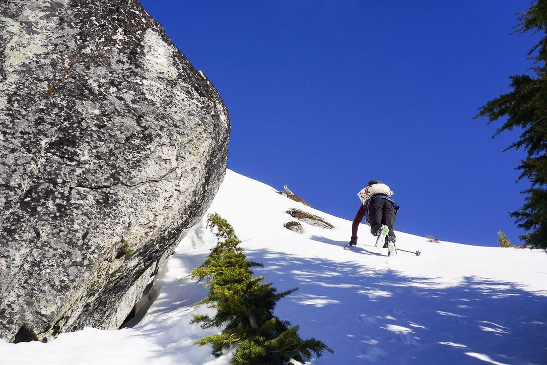
Snow cover made travel much easier.
We worked our way up the ridge until we reached a small bump (5800’) above a notch on the south ridge. We took a break here…. The rest of the route looked intimidating. Despite all the work we had already put in, things really get challenging beyond this point.

At 5800’, a look ahead at the moderately technical and exposed south ridge. The route eases up above this technical section. The route links steep snow bands to the right of the steep rock.
The first obstacle is dropping down to the notch below 5800’. The step down is exposed. It was a mixture of steep snow and rock slabs, but it goes with route finding and careful footing.
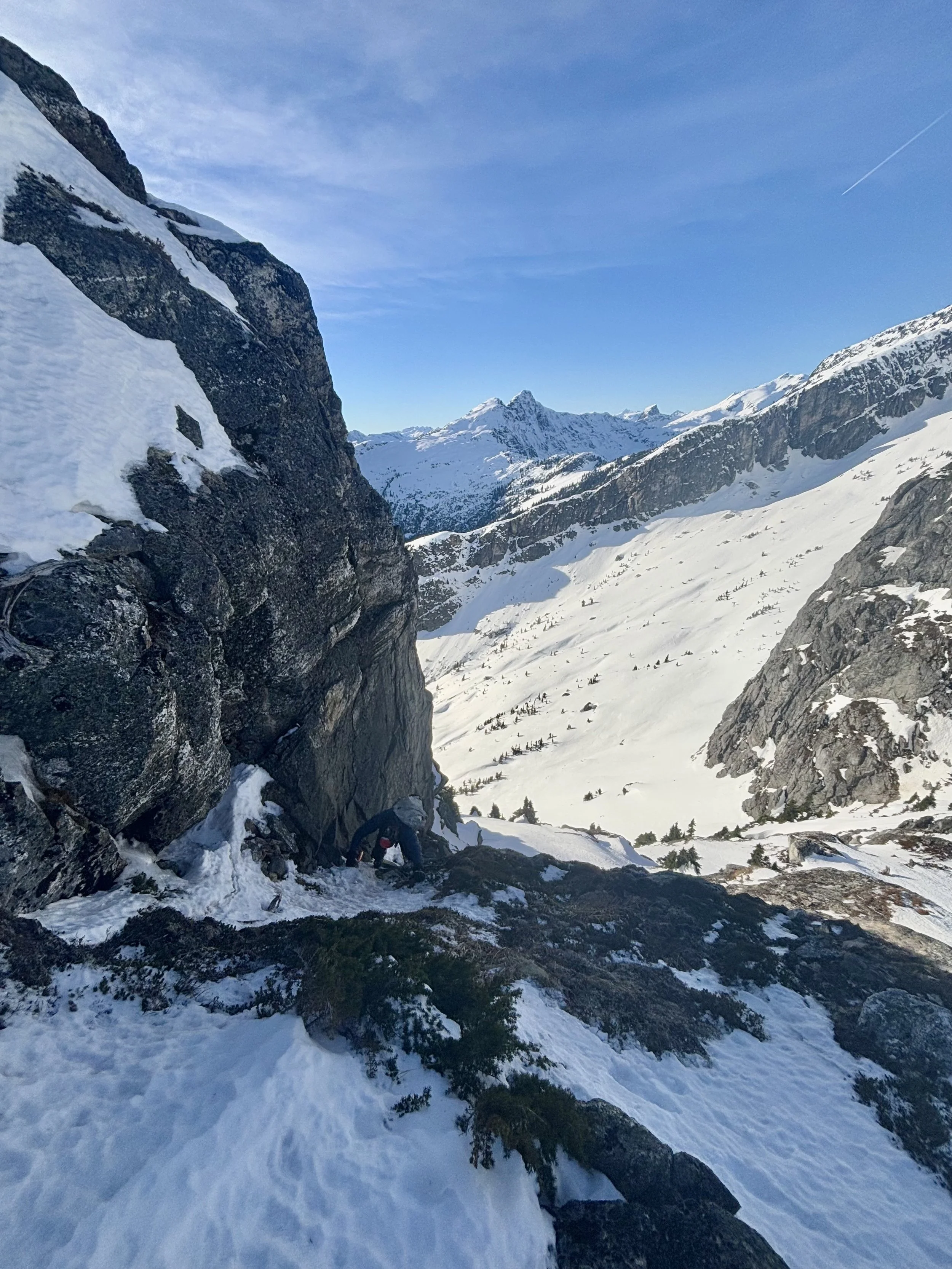
Climbing down the the notch, just below 5800’. Several options exist for getting down.
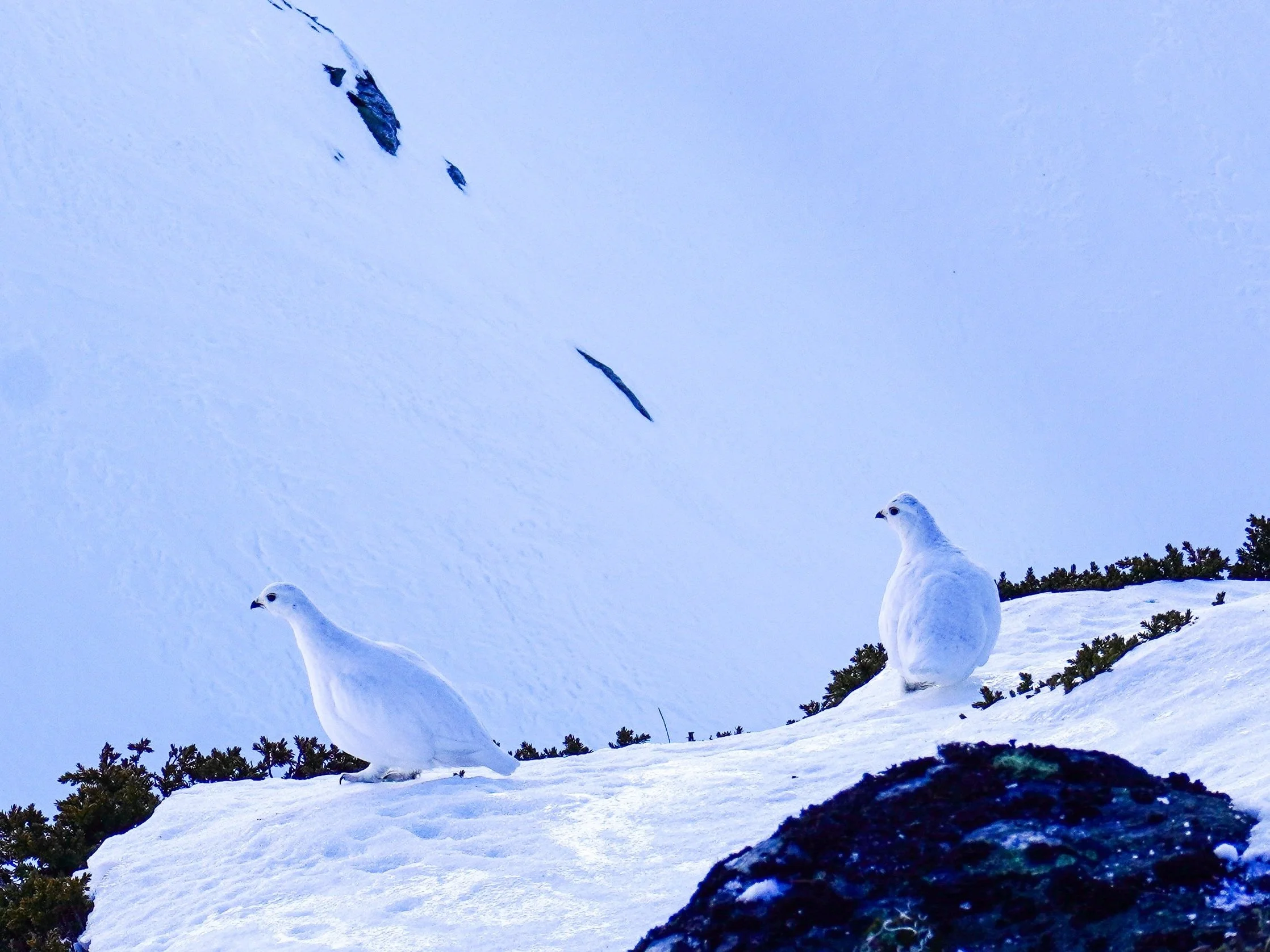
We met a family of 5 Ptarmigans… The yeti version of a chicken.
Looking beyond to the south ridge, we discussed our route choice and made a decision to leave the rope in our bag. The route looked quite complex, with slabs and heather below a foot of snow. We tried a few options, but ultimately opted to stay on the snow as most as possible. At one point, I estimated the snow angle was close to 60 degrees.

Weaving our way through thin snow, rock and heather along the south ridge. High consequence terrain required careful footing.

Steep snow and slabs on the south ridge of Davis Peak.
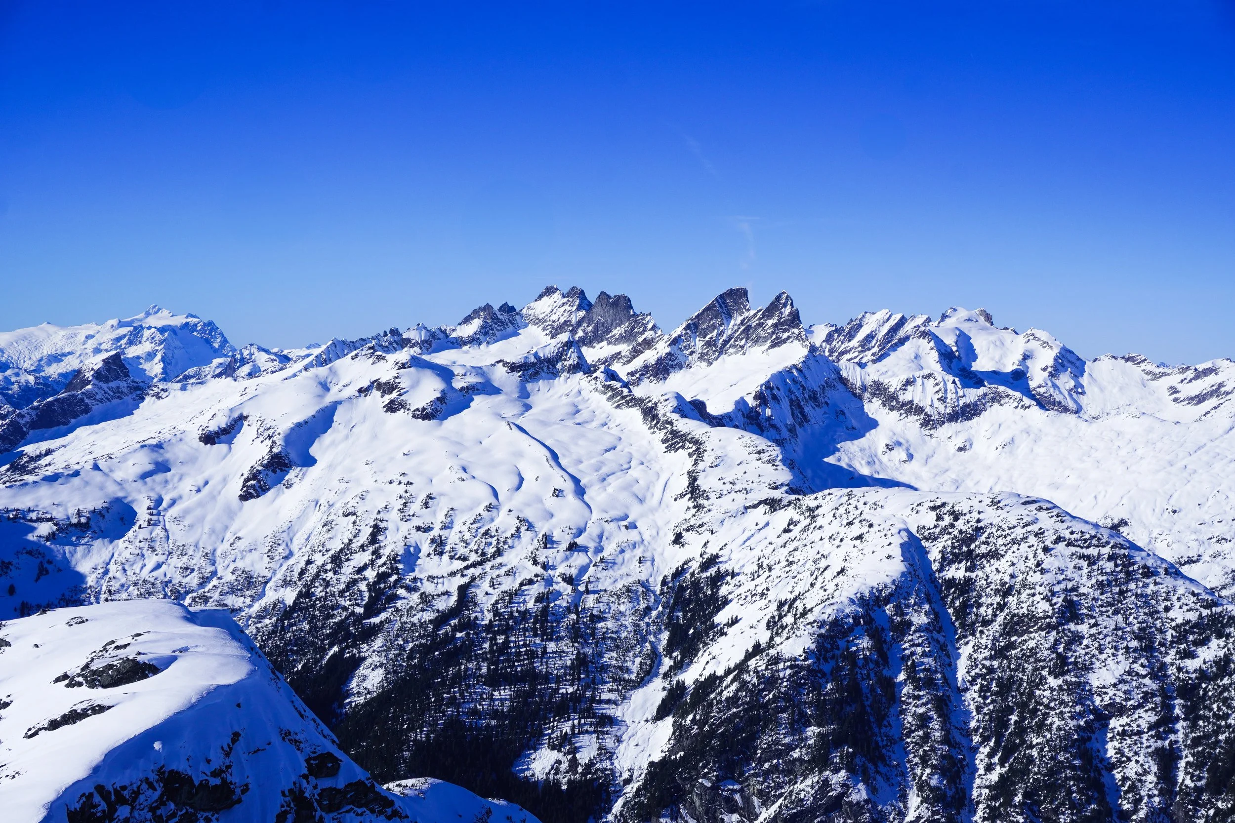
Above the technical part of the ridge, it’s a straightforward & magical walk to the summit. On the right side is a massive cornice, with Davis’ massive North face in the shadow and Luna Peak looming in the background. On the left side you have the Pickets, Baker, Shuksan. We felt lucky to be in the position we were at so early in the season.
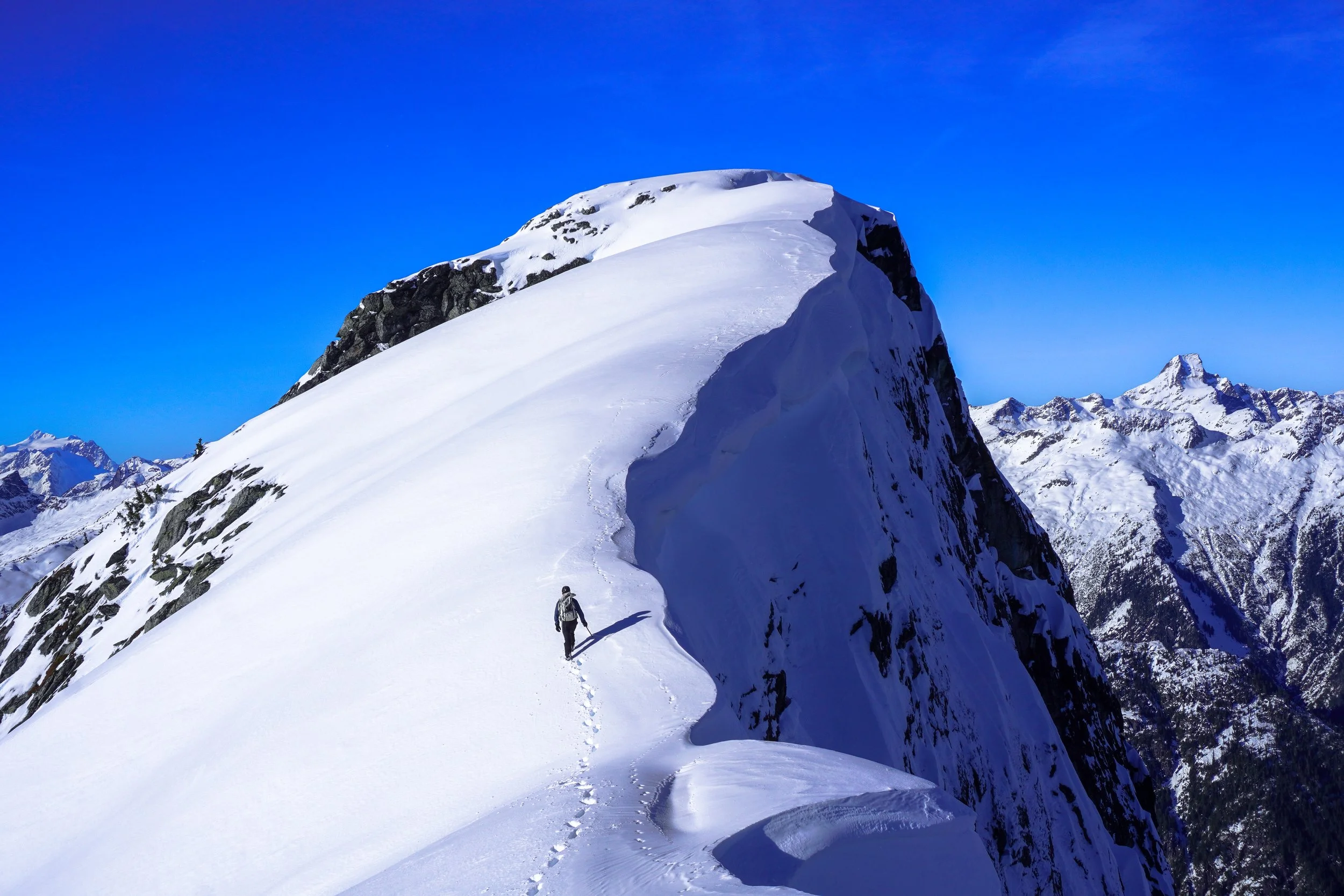
A ridge walk to remember. Goat tracks to the right of our footprints…. At one point the tracks went to the edge of the massive cornice above the north face of Davis peak.
Stunning.

Luna looms.

Never a dull moment together.
Temperatures on the summit were comfortable. We spent 15 minutes soaking up the views, taking pictures and enjoying life. It was 2PM and we knew it was time to turn around if we wanted to be back to the car before nightfall. Down climbing the steep bits on the south ridge required very careful footing. We did not rappel as customary, in order to save time. We both felt comfortable enough without the rope. Fortunately, the route was Southeast facing, so our steps were now in the shade and the snow was firm.
We retraced our bucket steps and made the climb back up to 5800’. It was an uneventful bushwhack back down to the truck and the views looking south were a treat. We talked about what a great day it had been and how excited we were for summer mountaineering and our future trips abroad. We reached the truck at nightfall, content with another awesome weekend.